
Ecuador: Part Four
The Avenue of the Volcanos
By: Zeren Earls - Apr 02, 2009


The Andes form the spine of Ecuador, running from north to south, with the east-west range positioned like the rungs of a ladder, separating valleys seven to nine thousand deep. The valleys, with fertile soil beneath a range of dormant and active volcanoes, are heavily settled and farmed, and have been the territory of different ethnic groups since pre-Inca times. The towns are connected both by railroad and by the Pan-American Highway.
Our bus journey started in Quito during the morning rush-hour traffic, as we descended through heavy fog into the valley surrounding the city, settled by Quechua people from the mountains. Bobbing up and down the trail, built by the Incas and called the Avenue of the Volcanoes, we connected to the Pan-American Highway, which runs from Columbia to Peru. We passed by lush green fields, farms, cows, pigs and sheep, and unfinished adobe buildings, which are generally completed as their owners save up money. Heavy rains in the past two years have ruined crops, resulting in increased food prices. To protect the local economy, the government levies high taxes on imported products.
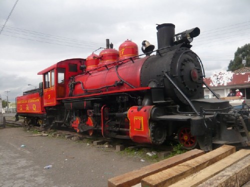
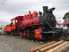
As we traveled through the Machachi Valley, the scenery changed to fields of potato as well as broccoli, which is processed into cow feed to improve milk production for this major dairy-farming area. The refreshment stop in Lasso rewarded us with a red locomotive dating back to the 50s. This museum piece still runs through the mountain tracks. A side road from Lasso brought us to Hosteria La Cienega, a former Spanish-owned estate (hacienda), now a hotel and restaurant. The main house, a stone mansion with large windows, stone-cobbled patios and Moorish-style fountains, was built in the mid-1600s, with a stone chapel added later on. Walking down an alley of eucalyptus trees, we arrived at the main building, which was furnished with elegant period furniture, and opened to formal gardens in the back.
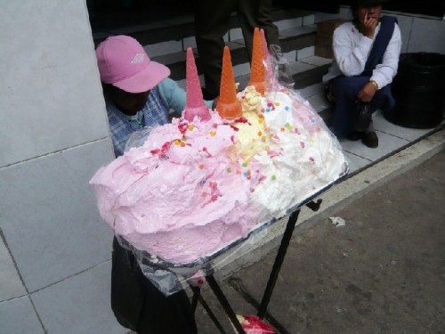
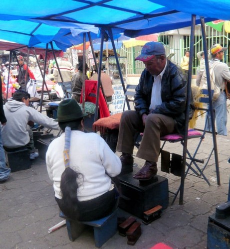
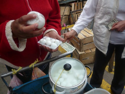
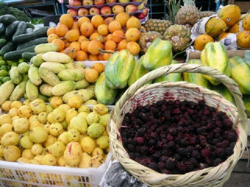
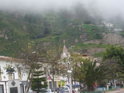
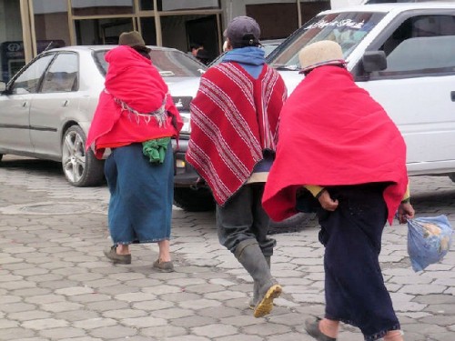
A major town on our itinerary was Latacunga, a city of 40,000 people founded by the Spanish in 1600 on a former Inca site; many of its buildings are constructed from local gray volcanic rock. This is the capital of Cotopaxi Province and its commercial center. Our trip coincided with the town's Tuesday market. Snacking on roasted and salted corn, we wondered through stalls of vegetables and fruit, attended by indigenas in fedoras and colorful skirts. Mothers shopped, carrying babies in shawls on their back. A vendor tried to entice a crowd of onlookers into buying medicinal herbs, while shoe-shine men and women hailed down customers across the way. Tasting partridge egg was a discovery.
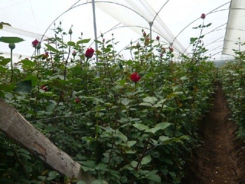
As we headed south, our next point of interest was Casa de Naranjo, an 85-hectare greenhouse, where red, white, yellow and hybrid roses are cultivated. Ecuador is a major exporter of roses throughout the world; Russia is its biggest market. Roses are cultivated year round; the delivery time is two months. Cut roses are brought indoors and wrapped in plastic nets before being dipped in a solution to rid them of insects. After the stems are resized for special orders, the roses are packaged in units of twenty and crated. Under refrigeration until picked up in freezer trucks, the crates are shipped overnight in temperature-controlled flights and met by other freezer trucks at destination.
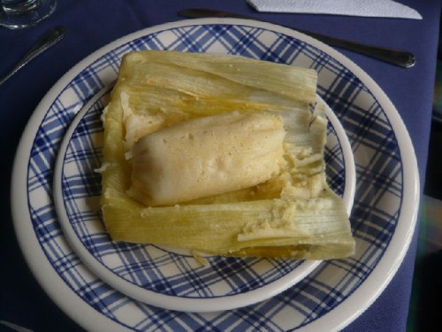
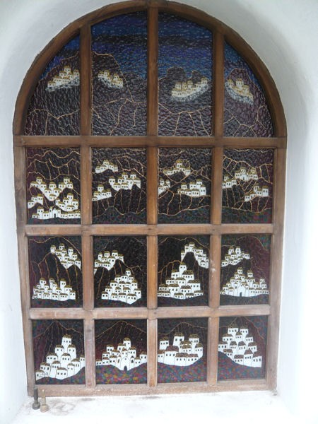
Lunch at Las Casas del Perez in Salcedo was the highlight of the day. Built by an artist and his wife, the adobe house was their home, studio and gallery, as well as a restaurant. Before I could sit down at the beautifully set table, I had to look around. Mr. Perez's creativity permeated stained glass windows, a sculpted and painted stairway, large and small table ceramics, and walls adorned with acrylic paintings. Learning that everything was for sale, I settled to eat quickly. The first course was humita, dough of white corn flour, spices and butter, rolled and wrapped in corn husk before steaming, and served with optional hot sauce. The main dish was roast chicken, accompanied by creamed carrots and mashed potatoes, followed by meringue with blackberry sauce. Afterwards, I departed with one of the artist's paintings executed in his unique style: thick bronze acrylic paint outlining simple forms and colors. The painting depicted palm trees, houses, and people of coastal Ecuador in planes with shades of brown and green, accented with copper dots.
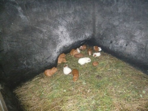
As we drove through Salcedo, parents crowded school gates to register their children at the public school of their choice. Schools are in session from 7 am to 1 pm and operate on a trimester system. Outside the town, broccoli fields gave way to alfalfa on the way to Ambato, the capital of Tungurahua Province. We passed a candy stand, where a man spun toffee out of brown sugar. Ambato is famed for its local food: spit-roasted guinea pig served with mashed potatoes and peanut sauce. Low in cholesterol because of their grass-only diet, guinea pigs are killed quickly by smashing their skulls. People travel long distances to Ambato for Ecuadorian food.
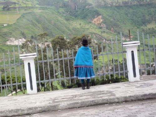
The landscape outside Ambato is of emerald mountains. Every inch of the vertical hillsides is farmed, turning the land into a patchwork quilt of every shade of green. Streams run in the ravines, cows graze, an occasional farmhouse appears, and clouds shrouding the peaks of the Chimborazo volcano, at 20,000 ft, add to the superb views. Chimboraza Province has the highest density in Ecuador of indigenous people, who also breed bulls for fighting - a legacy of the Spanish.
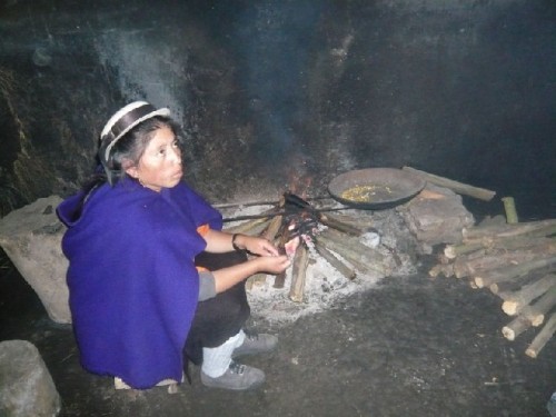
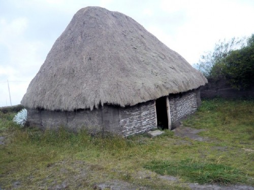
Stopping at Posada La Estacion in Chimborazo provided insight into native lifestyle and crafts. Llamas, happy at high altitude, graced the landscape. In a native hut filled with smoke, a woman kept a fire going to keep her guinea pigs warm. The animals lived in a sectioned grassy corner near a straw sleeping mat, shared by adults at night. The artisan shop nearby had craftsmen at work. One sanded and carved vegetable ivory, the egg-sized seeds of the lowland tagua palm, into decorative objects and jewelry. The soft seed hardens to an ivory-like consistency when peeled. Another artisan painted naïve scenes on sheepskin, stretched in a wood frame. Both crafts enriched my folk art collection.
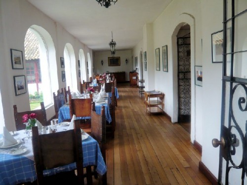
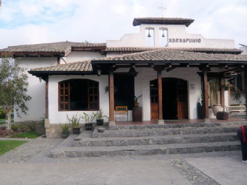
Driving another hour by lush high-altitude fields of oat and fava beans, we arrived at 5 pm in Riobamba, capital of Chimborazo Province, where we spent the night. Having been on the road since 7:30 am, we were ready to settle into our hotel, the Abraspungo Riobamba beautifully furnished with country antiques and folk art. Instead of numbers, the guest rooms had names. Ours was named after the volcano Illizia. At dinner, we enjoyed vegetable soup, dolphin, broccoli, squash, mashed potatoes and chocolate cake. Aji, a hot sauce made of orange-colored tree tomatoes, onions and red peppers, and used by locals on everything but dessert, was available for additional flavoring.
I n the morning I walked around the hotel to see its collection in daylight. I was intrigued by the wall display of handmade white felt hats, worn especially for fiestas and other special occasions. The hats varied in size and shape of brim and crown, as well as color and length of streamers and tassels, all indicating the wearer's community or ethnic group. Dark, commercially made fedoras, are increasingly replacing white ones.
Riobamba is the center of Ecuador's military base because of the city's geographically strategic location. After winning its war of independence from Spain, Ecuador's first constitution was written and signed here in 1830. As we drove through town, Roberta gave us the daily news: A drug cartel had just been discovered in Ecuador, causing a break in diplomatic relations between Columbia and Ecuador. Columbian guerillas hide in Ecuador, facilitating drug trafficking between the countries. Roberto also reported that the southwestern provinces and all coastal villages had been flooded due to rain.
Feeling fortunate that we had not been affected by the rain, we continued southward to catch our "Devil's Nose" train ride in Alausi. We passed by a cement factory, one of four in the country. Further down, farmers cultivated land by hand, while children worked in mini-plots. Most people in Ecuador are farmers. 30% of the population is indigenous, 60% mestizo and 10% Afro-Ecuadorian. Most people are represented by a political party. Indigenous people and trade unions were able to put the current president in office eight years ago.
Steaming fast-food carts lined the street in Colta, a small village home to Ecuador's oldest church, built in 1534. People pumped water from a lake, while an Andean gull enjoyed its fresh waters. Three-to four-foot-tall quinoa plants thrived in the high elevations. Farmers shake this plant to obtain the kernels, which are 18% protein and are cooked as cereal. The Guamote Valley emerged, divided into four plazas, each with its own product: potatoes, vegetables, fruits and animals. Herders protected themselves from the mountain chill in brightly colored ponchos and hats. Looking over and through the clouds, we passed through the valley, finally arriving in Alausi.
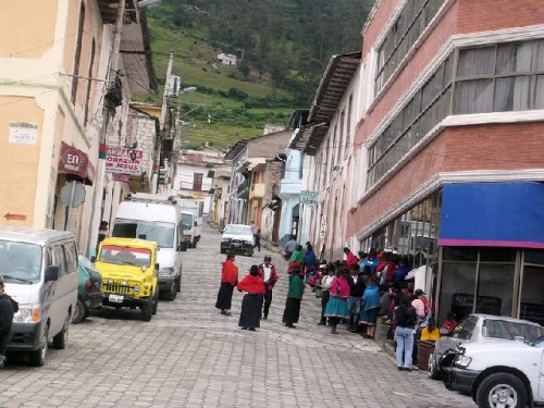
The giant statue of St. Peter, patron saint of Alausi, gazed over the city, partially shrouded in clouds at 7704 feet, as we approached the city. Here we were to catch the train for our much-anticipated descent of the Devil's Nose rock face. Originally, we were to depart from Riobamba for this train ride, but due to washed-out tracks we started in Alausi, shortening the trip from five hours to one and a half. Until the train's arrival, I wandered away from the station to walk around town. A colorful group of indigenas crowded in front of the central bank, waiting for it to open; others, prominent in their black fedoras, sat on benches in the town center; girls in brown uniforms walked to school; a vendor caught my attention with his cabuya bags, made of fiber from agave cactus. Naturally, I had to have one before I rushed back to catch the train.
To be continued: The Devil's Nose train ride and the Southern Sierra